

Navigation apps for iPhone have revolutionized travel, offering specialized tools for drivers, commuters, outdoor enthusiasts, and EV owners. Whether you’re weaving through city traffic, reserving parking, or charting off-road trails, these apps provide real-time updates, offline maps, and unique features like EV charging locators or hunting land boundaries. From Google Maps’ unmatched global coverage to onX Offroad’s rugged trail navigation, this curated list of 2025’s top 15 iPhone navigation apps ensures every journey is seamless. Download from the App Store and embark on your next adventure with confidence.
Hey, plotting your next adventure with the top navigation apps for 2025? Awesome choice for seamless travel! But let’s make those journeys even better with great food. Our recipe organizer app has you covered: instantly import recipes from Instagram, TikTok, or Pinterest, create meal plans to save time and eat better, and generate smart grocery lists sorted by store aisle. Download it today, then hit the road with confidence and a plan for delicious meals!

1. Google Maps
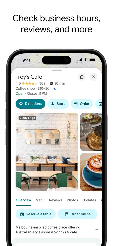
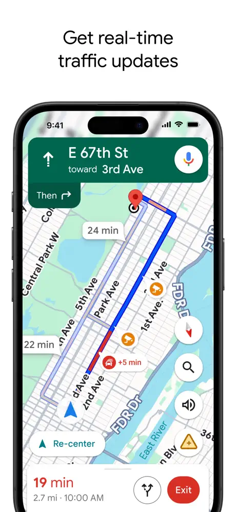
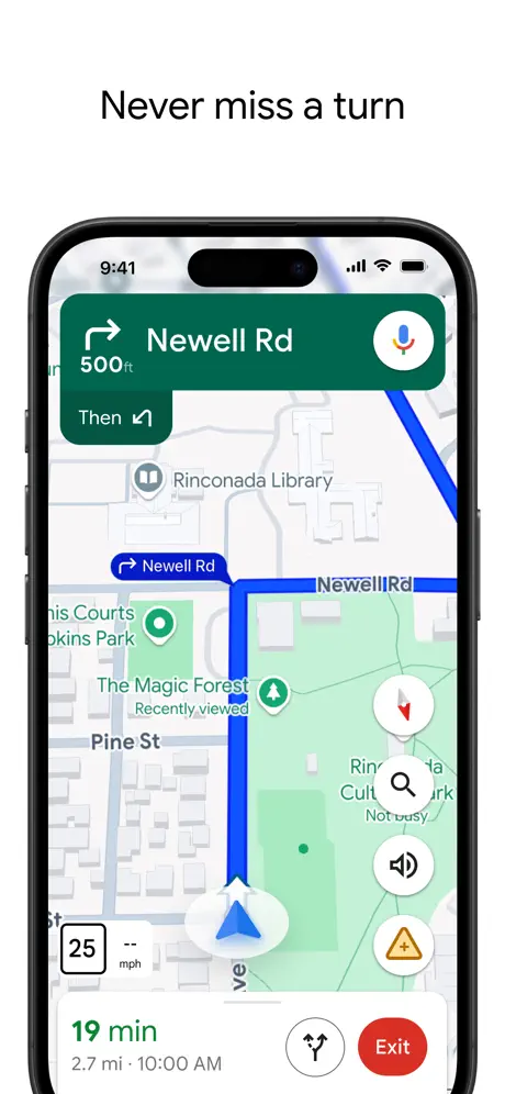
Google Maps delivers comprehensive navigation for driving, walking, biking, and public transit across millions of global locations. It features real-time traffic updates, offline maps, and Street View for visual guidance. Live View AR walking directions enhance pedestrian navigation, while transit schedules and local business reviews help plan trips. Users can create multi-stop routes and explore nearby attractions effortlessly.
Its vast database and frequent updates make it a cornerstone for travelers. Google Maps’ integration with ride-sharing and transit options simplifies urban and rural navigation.
Key Highlights
- Real-time traffic updates and road closure alerts.
- Offline maps for navigation without internet.
- Live View AR for immersive walking directions.
- Transit schedules and ride-sharing integration.
- Street View and indoor maps for venues.
Who It’s Best For
- Commuters needing real-time traffic data.
- Travelers navigating unfamiliar cities.
- Pedestrians using AR walking directions.
- Transit users planning public transport.
- Drivers organizing multi-stop routes.
Contact Information:
- Website: www.google.com/maps
- App store: apps.apple.com/us/app/google-maps
- Google Play: play.google.com/store/apps/details

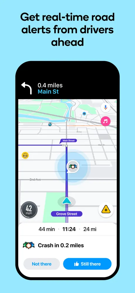
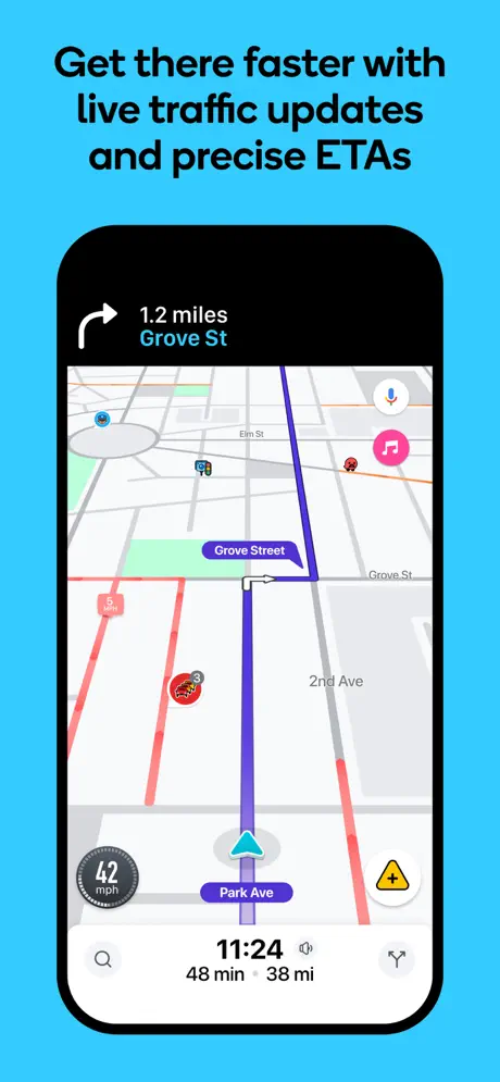
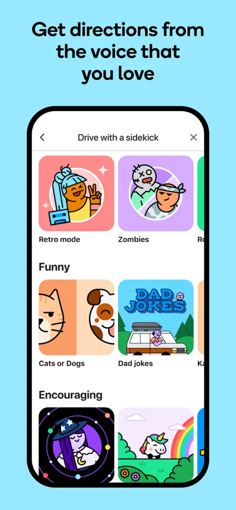
2. Waze – GPS, Maps & Traffic
Waze is a community-driven navigation app offering real-time traffic, road hazard, and police alerts. Users contribute updates on accidents, gas prices, or roadblocks, enabling dynamic rerouting to avoid delays. Features include speed limit warnings, toll cost estimates, and music app integration for in-car entertainment. It’s perfect for dodging congestion and optimizing commutes.
Waze’s crowdsourced model ensures timely road information. Its driver-focused features make it ideal for daily commutes and long-distance travel.
Key Highlights
- Crowdsourced alerts for traffic and hazards.
- Dynamic rerouting to avoid delays.
- Gas price updates for cost savings.
- Speed limit warnings for safety.
- Music app integration for in-car entertainment.
Who It’s Best For
- Drivers seeking real-time traffic avoidance.
- Commuters relying on community alerts.
- Users looking for gas price savings.
- Long-distance drivers needing efficient routes.
- Music enthusiasts integrating playlists.
Contact Information:
- Website: www.waze.com
- App store: apps.apple.com/us/app/waze-navigation-live-traffic
- Google Play: play.google.com/store/apps/details

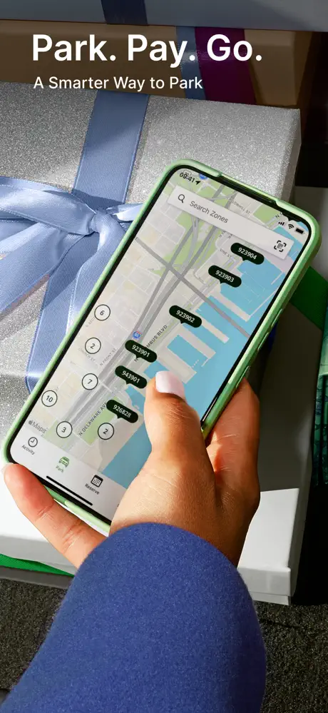
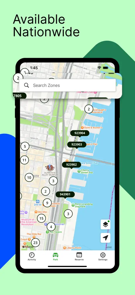
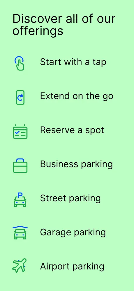
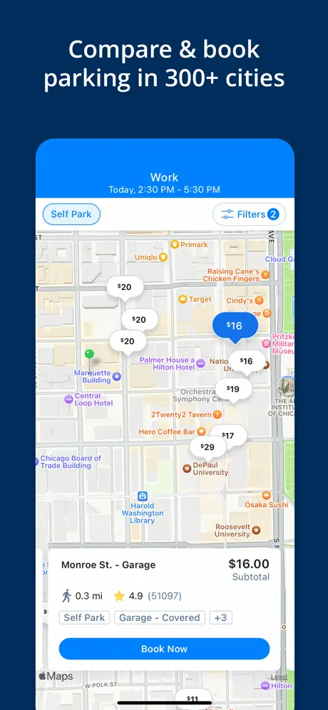
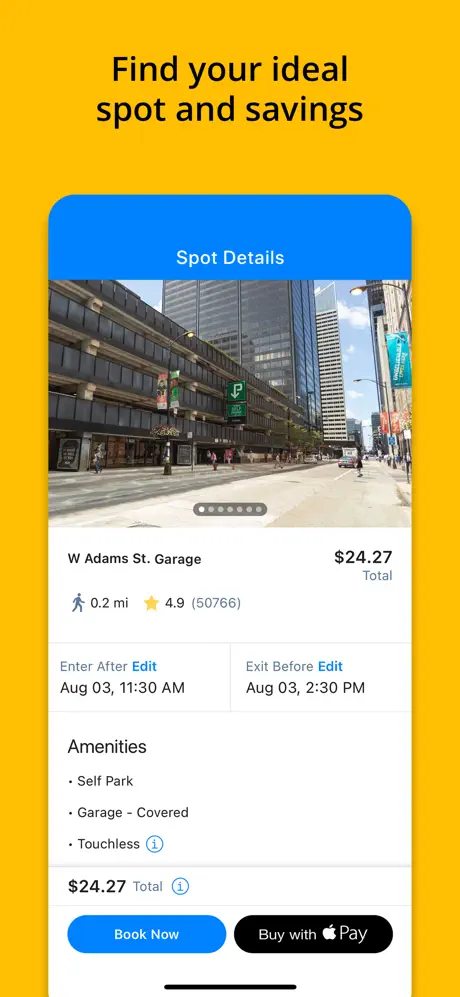
3. ParkMobile: Park. Pay. Go.
ParkMobile simplifies parking in over 500 U.S. cities with mobile payments for street, lot, and garage spaces. Users can reserve spots in advance, extend sessions remotely, and receive expiration alerts to avoid fines. The app supports contactless payments and integrates with navigation to locate parking zones, streamlining urban parking.
Its broad coverage and reservation system reduce parking hassles. ParkMobile’s intuitive design is perfect for busy city drivers and event-goers.
Key Highlights
- Mobile payments for street and lot parking.
- Parking spot reservations in advance.
- Remote session extensions for flexibility.
- Expiration alerts to avoid fines.
- Contactless payments for convenience.
Who It’s Best For
- Urban drivers needing quick parking solutions.
- Travelers reserving spots for events.
- Users prioritizing contactless payments.
- Commuters avoiding parking fines.
- Drivers in U.S. cities.
Contact Information:
- Website: vimeo.com
- App store: apps.apple.com/us/app/parkmobile-park-pay-go
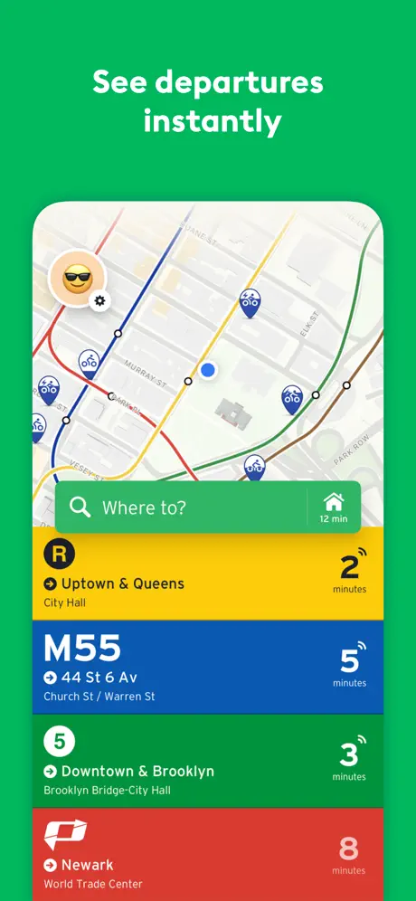
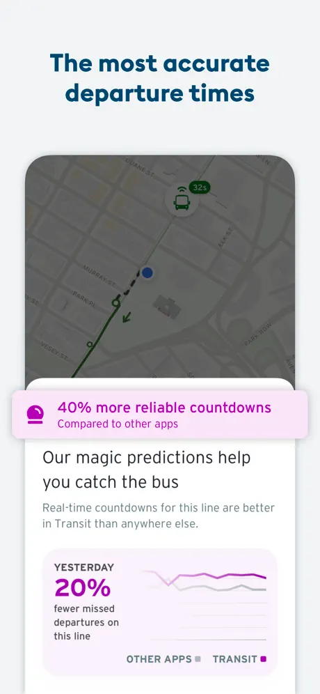
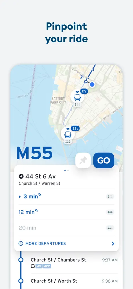
4. Transit • Subway & Bus Times
Transit provides real-time schedules for buses, subways, trains, and ferries in over 300 cities worldwide. It offers trip planning, live vehicle tracking, and service disruption alerts. Users can access offline schedules, integrate with bike-share or ride-hail services, and follow step-by-step navigation. It’s ideal for urban commuters navigating complex transit systems.
Its multi-modal support and real-time data streamline public transport. Transit’s user-friendly interface makes city travel efficient and stress-free.
Key Highlights
- Real-time schedules with live vehicle tracking.
- Trip planning with bike-share integration.
- Offline schedules for connectivity gaps.
- Service disruption alerts for reliability.
- Step-by-step navigation for transit routes.
Who It’s Best For
- Public transit users in global cities.
- Commuters needing real-time schedules.
- Travelers combining transit with biking.
- Users navigating offline urban areas.
- Multi-modal travelers seeking flexibility.
Contact Information:
- Website: transitapp.com
- App store: apps.apple.com/us/app/transit-subway-bus-times
- Google Play: play.google.com/store/apps/details
- E-mail: info@transit.app
- Facebook: www.facebook.com/transitapp
- Instagram: www.instagram.com/transit.app
- LinkedIn: www.linkedin.com/company/transit-app
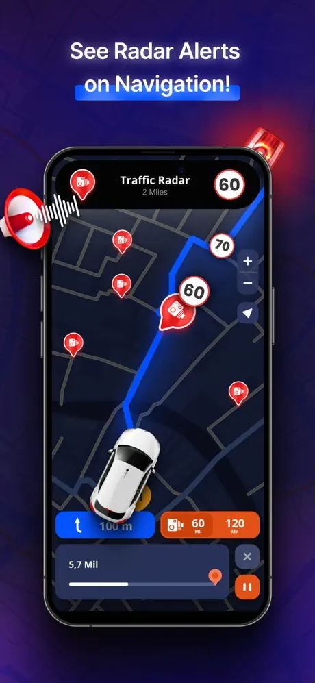
5. MapXplorer – Navigation, Radar
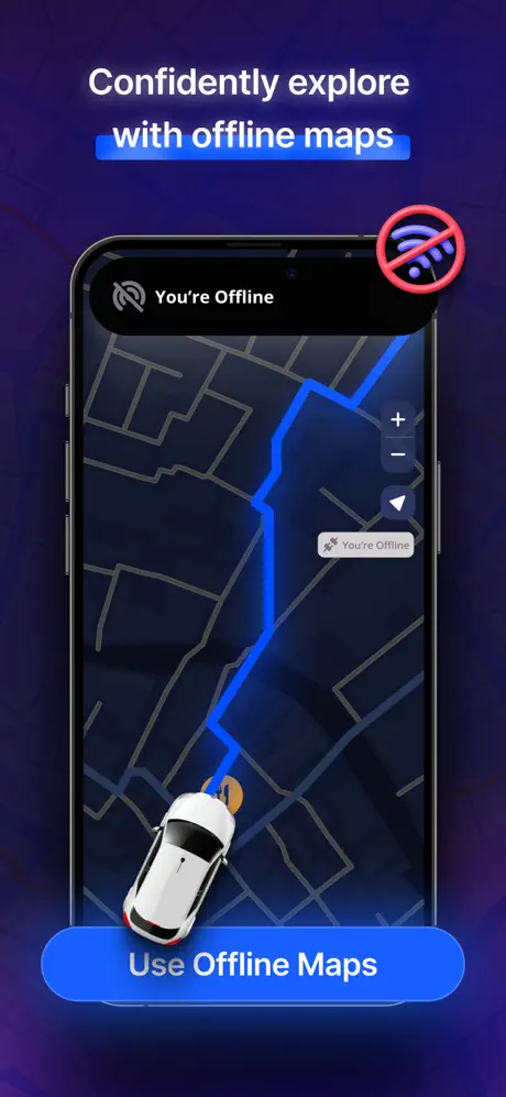
MapXplorer offers offline navigation with speed radar alerts and real-time traffic updates for driving and walking. It includes voice-guided directions, speed limit warnings, and customizable routes. Offline maps ensure functionality in low-signal areas, making it reliable for urban commutes or rural adventures. Its design prioritizes ease of use.
MapXplorer’s offline capabilities and radar features cater to versatile travelers. Its straightforward interface enhances navigation for all users.
Key Highlights
- Offline maps for navigation without internet.
- Speed radar and limit alerts for safety.
- Real-time traffic updates for efficient routing.
- Voice-guided directions for hands-free use.
- Customizable routes for personalized trips.
Who It’s Best For
- Drivers needing speed limit warnings.
- Travelers navigating offline areas.
- Users seeking voice-guided directions.
- Adventurers exploring rural routes.
- Commuters wanting traffic updates.
Contact Information:
- Website: mapxplorer-ios.goldlabtechnology.com
- App store: apps.apple.com/us/app/mapxplorer-navigation-radar
- Google Play: play.google.com/store/apps/details
- E-mail: business@goldlabtechnology.com

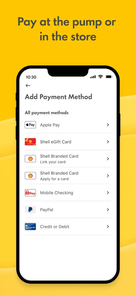
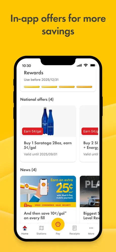
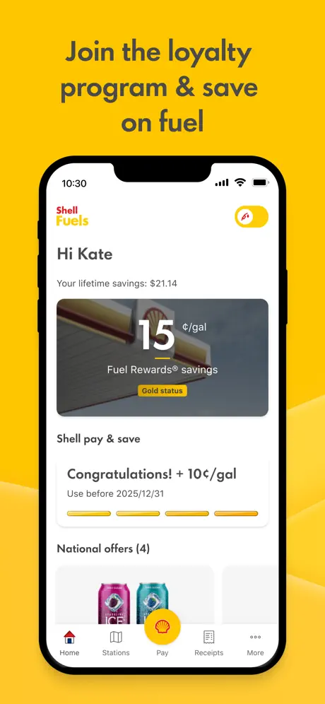
6. Shell – Fuel, Charge & More
Shell streamlines fuel and EV charging with a station locator and mobile payment system. Users can find Shell stations, pay at pumps or chargers, and earn loyalty rewards. The app provides navigation to stations and supports EV drivers with charging point access, ideal for long-distance travel or daily commutes.
Its integration of fuel, EV charging, and rewards makes it highly practical. Shell’s mobile payments offer convenience for drivers on the go.
Key Highlights
- Station locator for fuel and EV charging.
- Mobile payments for pumps and chargers.
- Loyalty rewards for frequent users.
- Navigation to Shell stations.
- EV charging access for electric vehicles.
Who It’s Best For
- Drivers locating fuel stations.
- EV owners finding charging points.
- Users seeking mobile payment options.
- Frequent travelers earning rewards.
- Road trippers needing convenience.
Contact Information:
- Website: www.shell.com
- App store: apps.apple.com/bg/app/shell-fuel-rewards
- Google Play: play.google.com/store/apps/details
- Facebook: www.facebook.com/Shell
- Twitter: x.com/shell
- Instagram: www.instagram.com/shell
- LinkedIn: www.linkedin.com/company/shell

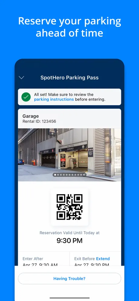
7. SpotHero
SpotHero helps users find, book, and pay for parking in thousands of garages and lots across major U.S. and Canadian cities. It offers advance reservations, price comparisons, and navigation to parking spots. The app supports event parking, airport parking, and daily commutes, ensuring hassle-free parking solutions.
SpotHero’s transparent pricing and booking system simplify urban parking. Its navigation integration ensures users reach their reserved spots seamlessly.
Key Highlights
- Advance reservations for parking spots.
- Price comparisons for cost-effective choices.
- Navigation to booked parking locations.
- Supports garages, lots, and airport parking.
- Available in major U.S. and Canadian cities.
Who It’s Best For
- Event-goers reserving parking.
- Commuters seeking affordable spots.
- Travelers navigating to parking locations.
- Users comparing parking prices.
- Drivers in North American cities.
Contact Information:
- Website: spothero.com
- App store: apps.apple.com/us/app/spothero-1-rated-parking-app
- Google Play: play.google.com/store/apps/details
- Facebook: www.facebook.com/SpotHero
- Instagram: www.instagram.com/spothero
- Twitter: x.com/SpotHero

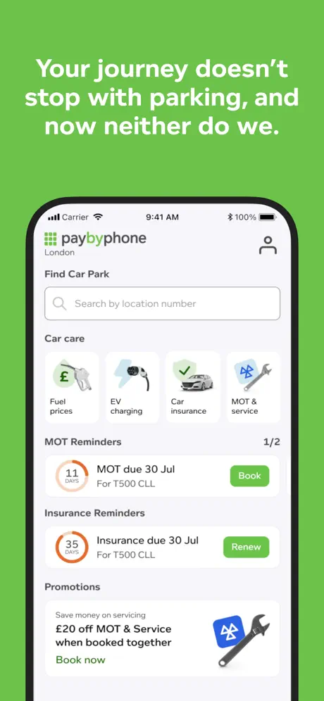
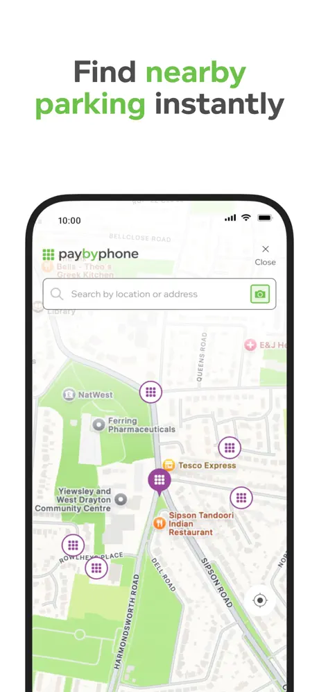
8. PayByPhone Parking
PayByPhone provides contactless parking payments in over 1,000 cities worldwide. Users can pay for street or lot parking, extend sessions remotely, and receive expiration reminders to avoid fines. The app integrates with navigation to locate parking zones, making it ideal for quick stops in busy urban areas.
Its global reach and remote management features enhance parking convenience. PayByPhone’s simple interface suits travelers and commuters alike.

Key Highlights
- Contactless payments for street and lot parking.
- Remote session extensions for flexibility.
- Expiration reminders to avoid fines.
- Navigation to parking zones.
- Available in 1,000+ cities worldwide.
Who It’s Best For
- Urban drivers needing quick payments.
- Travelers extending parking remotely.
- Users avoiding parking fines.
- Commuters navigating parking zones.
- Global travelers in major cities.
Contact Information:
- Website: www.paybyphone.com
- App store: apps.apple.com/us/app/paybyphone-parking
- Google Play: play.google.com/store/apps/details
- Facebook: www.facebook.com/PayByPhone.N.America
- Twitter: x.com/PayByPhone
- Instagram: www.instagram.com/paybyphone
- LinkedIn: www.linkedin.com/company/paybyphone-technologies

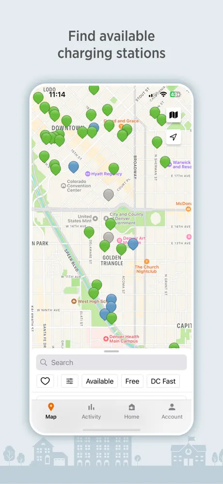
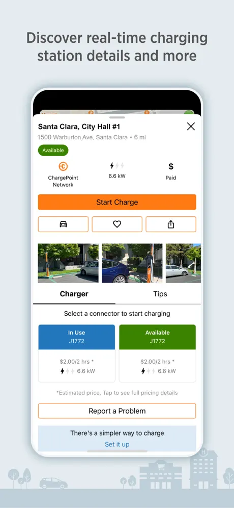
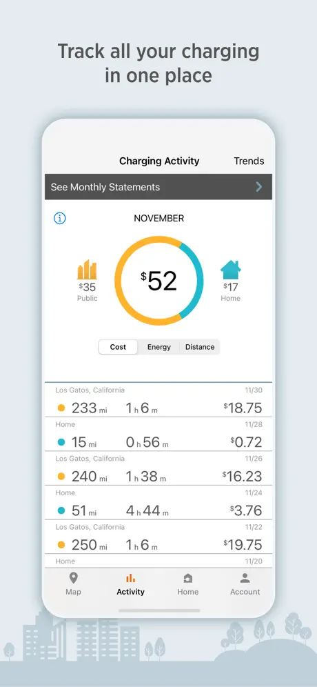
9. ChargePoint
ChargePoint connects EV drivers to hundreds of thousands of charging stations across North America and Europe. It offers real-time station availability, navigation to chargers, and mobile payments. Users can filter for fast chargers, check wait times, and manage charging sessions, perfect for EV road trips or daily commutes.
ChargePoint’s extensive network and real-time data are vital for EV owners. Its navigation tools ensure quick and efficient charger access.
Key Highlights
- Access to hundreds of thousands of chargers.
- Real-time availability and station filters.
- Navigation to nearby charging points.
- Mobile payments for charging sessions.
- Fast charger options for quick stops.
Who It’s Best For
- EV drivers seeking charging stations.
- Road trippers needing fast chargers.
- Users wanting real-time station data.
- Commuters navigating to chargers.
- EV owners managing sessions.
Contact Information:
- Website: www.chargepoint.com
- App Store: apps.apple.com/us/app/chargepoint
- Google Play: play.google.com/store/apps/details
- Facebook: www.facebook.com/ChargePoint
- Instagram: www.instagram.com/chargepoint
- Twitter: x.com/chargepointnet
- LinkedIn: www.linkedin.com/company/chargepoint
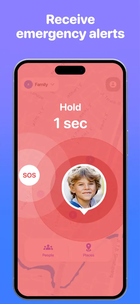
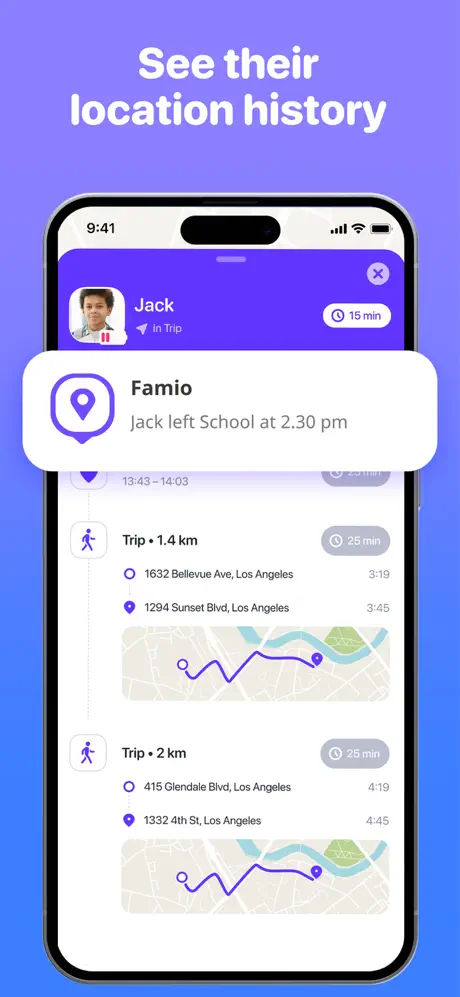
10. Famio – Find My Family, Friends
Famio enables real-time location sharing for family and friends, with navigation to shared locations. It includes geofencing alerts for arrivals or departures, SOS signals for emergencies, and battery level monitoring. The app ensures group safety and coordination, ideal for family trips or parental oversight.
Its safety and group-focused features make it unique. Famio’s navigation tools keep users connected during travel or daily routines.

Key Highlights
- Real-time location sharing for groups.
- Geofencing alerts for arrivals/departures.
- SOS signals for emergency safety.
- Navigation to shared locations.
- Battery level monitoring for devices.
Who It’s Best For
- Families tracking loved ones.
- Group travelers coordinating locations.
- Parents ensuring child safety.
- Users needing SOS features.
- Friends sharing real-time locations.
Contact Information:
- Website: gismart.com
- App store: apps.apple.com/us/app/famio-find-my-family-friends
- Google Play: play.google.com/store/apps/details

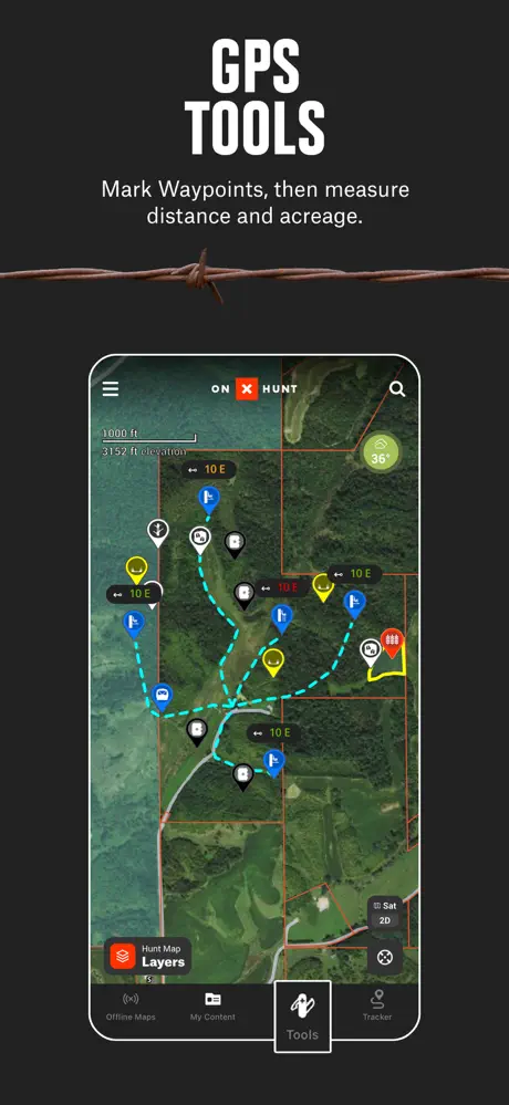
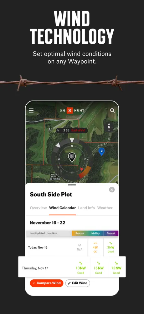
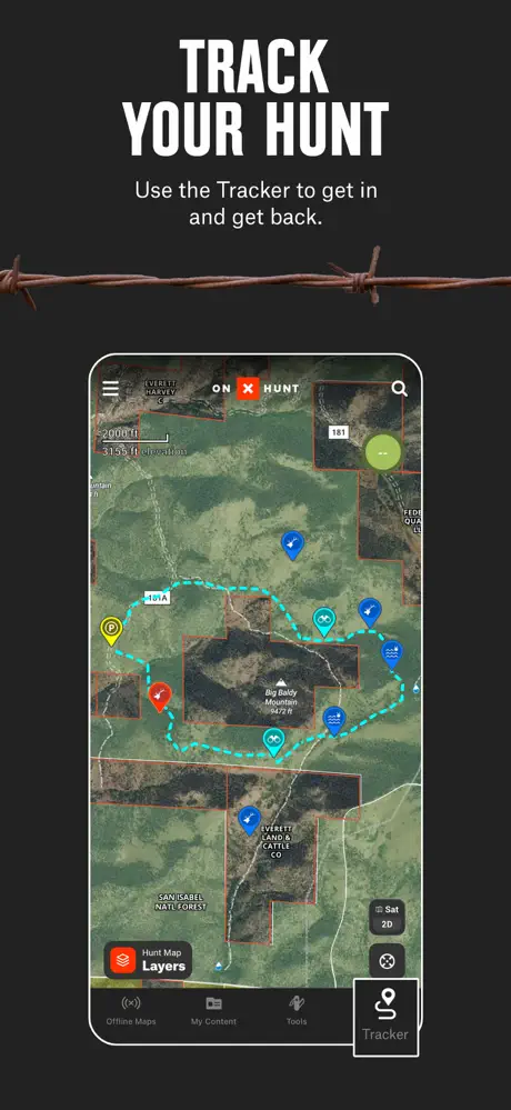
11. onX Hunt – GPS Hunting Maps
onX Hunt provides GPS navigation for hunters with detailed maps of public and private lands across the U.S. It offers offline maps, property boundary data, and waypoints for tracking game or campsites. Users can share locations for group hunts, making it essential for hunting in remote areas.
Its specialized maps and offline reliability enhance hunting safety and planning. onX Hunt’s navigation tools are tailored for outdoor precision.
Key Highlights
- Maps of public and private lands.
- Offline maps for remote hunting areas.
- Waypoints for game and campsite tracking.
- Property boundaries for legal compliance.
- Location sharing for group coordination.
Who It’s Best For
- Hunters navigating public lands.
- Outdoor enthusiasts using offline maps.
- Users tracking game waypoints.
- Groups sharing hunting locations.
- Adventurers ensuring land compliance.
Contact Information:
- App Store: apps.apple.com/us/app/onx-hunt-gps-hunting-maps
- Website: www.onxmaps.com
- Facebook: www.facebook.com/onXmaps
- Instagram: www.instagram.com/onx_maps
- Twitter: x.com/onxmaps
- LinkedIn: www.linkedin.com/company/onxmaps

12. MTA TrainTime
MTA TrainTime offers real-time schedules for Metro-North and Long Island Rail Road in New York. It includes mobile ticketing, trip planning, live train tracking, and service alerts. Users can navigate stations and plan commutes, making it indispensable for regional rail travelers in the New York area.
Its focus on MTA services ensures reliable transit information. MTA TrainTime’s real-time features streamline rail commuting.
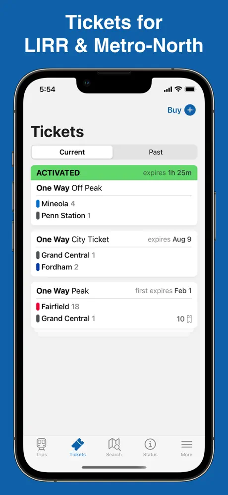
Key Highlights
- Real-time schedules for MTA trains.
- Mobile ticketing for seamless travel.
- Live train tracking for accuracy.
- Service alerts for disruptions.
- Station navigation for commuters.
Who It’s Best For
- MTA rail commuters in New York.
- Travelers needing real-time schedules.
- Users purchasing mobile tickets.
- Commuters navigating stations.
- Riders avoiding service disruptions.
Contact Information:
- Website: new.mta.info
- App Store: apps.apple.com/us/app/mta-traintime
- Google Play: play.google.com/store/apps/details
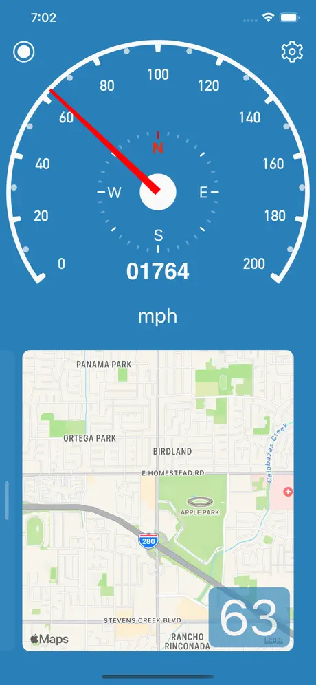
13. Speedometer Simple
Speedometer Simple is a digital speedometer with navigation and real-time speed tracking for drivers. It features HUD mode for windshield projection, speed limit alerts, and trip logging for distance and time. The app supports customizable speed units, ideal for monitoring speed in unfamiliar regions or during long drives.
Its minimalist design and HUD mode prioritize driving safety. Speedometer Simple’s trip logging appeals to users tracking travel metrics.
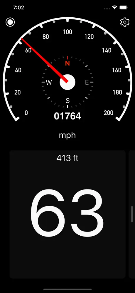
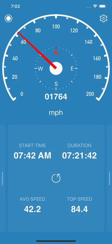
Key Highlights
- Real-time speed tracking with HUD mode.
- Speed limit alerts for safe driving.
- Trip logging for distance and time.
- Simple interface for easy navigation.
- Customizable speed units (mph, km/h).
Who It’s Best For
- Drivers monitoring real-time speed.
- Night drivers using HUD mode.
- Users logging trip data.
- Travelers needing speed limit alerts.
- Drivers in unfamiliar regions.
Contact Information:
- Website: speedometersimple.com
- App Store: apps.apple.com/us/app/speedometer-simple
- Google Play: play.google.com/store/apps/details

14. Neshan Map – Navigation & Traffic
Neshan Map provides navigation with real-time traffic updates, voice-guided directions, and offline maps for driving and walking. It includes speed camera alerts and route planning, with multilingual support for global users. The app is reliable for urban commutes or rural exploration, ensuring efficient travel.
Its offline functionality and voice guidance suit diverse travelers. Neshan Map’s traffic data optimizes routes for efficiency.
Key Highlights
- Real-time traffic and speed camera alerts.
- Offline maps for low-signal areas.
- Voice-guided directions for hands-free use.
- Route planning for driving and walking.
- Multilingual support for global travelers.
Who It’s Best For
- Drivers needing traffic updates.
- Travelers using offline maps.
- Users seeking voice-guided navigation.
- Global travelers needing multilingual support.
- Commuters in urban or rural areas.
Contact Information:
- Website: nmap.app
- App Store: apps.apple.com/us/app/neshan-map
- Google Play: play.google.com/store/apps/details
- E-mail: info@Nmap.app
- Phone: +31 20 523 3670

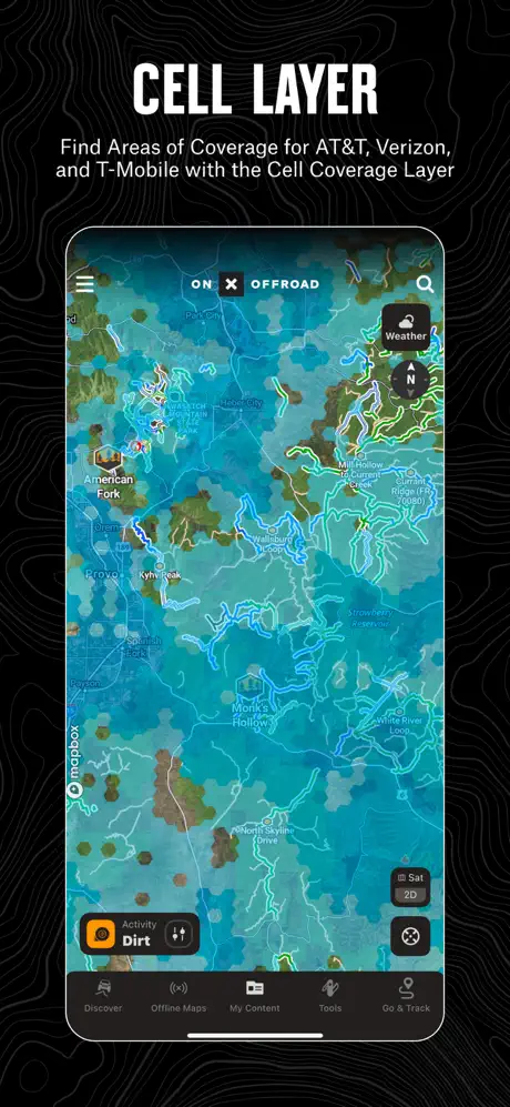
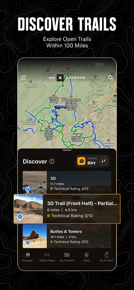
15. onX Offroad – Trail Maps & GPS
onX Offroad offers GPS navigation for off-road adventures with detailed trail maps across the U.S. It features offline maps, 3D trail views, and waypoints for campsites or obstacles. Users can share routes for group trips and check trail difficulty ratings, ideal for off-roading, overlanding, or camping.
Its trail-specific maps and offline reliability are perfect for rugged exploration. onX Offroad’s 3D navigation enhances safety and planning in remote terrains.
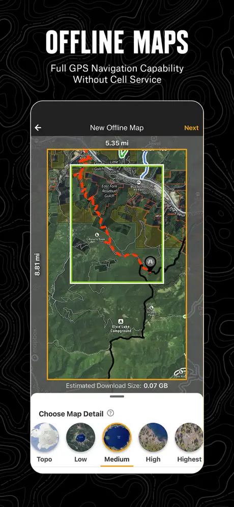
Key Highlights
- Detailed trail maps with 3D views.
- Offline maps for remote adventures.
- Waypoints for campsites and obstacles.
- Route sharing for group coordination.
- Trail difficulty ratings for safe planning.
Who It’s Best For
- Off-road enthusiasts navigating trails.
- Adventurers using offline maps.
- Campers marking waypoints.
- Groups sharing off-road routes.
- Overlanders exploring rugged terrains.
Contact Information:
- Website: www.onxmaps.com
- App Store: apps.apple.com/us/app/onx-offroad-trail-maps-gps
- Facebook: www.facebook.com/onxoffroad
- Instagram: www.instagram.com/onxoffroad
- Twitter: x.com/onxmaps
- LinkedIn: www.linkedin.com/company/onxmaps
Conclusion
The top 15 navigation apps for iPhone in 2025 cater to every type of traveler, offering unmatched tools to simplify and enhance journeys. Google Maps delivers global versatility with real-time traffic and AR walking directions, while Waze keeps drivers ahead of congestion with community-driven alerts. Urban commuters benefit from Transit’s public transport schedules and ParkMobile’s parking solutions, while EV owners rely on ChargePoint’s vast charging network. For outdoor enthusiasts, onX Hunt and onX Offroad provide precise maps for hunting and off-road adventures. Whether you’re navigating city streets, reserving parking, or exploring remote trails, these apps ensure seamless travel. Download one or combine several from the App Store to match your needs, and embark on your next journey with confidence and ease.