

Hunting’s more than just heading into the woods with a rifle or bow – it’s about preparation, strategy, and knowing your environment. Whether you’re tracking whitetail deer or scouting new public land, the right app can make all the difference. From GPS maps to wind forecasts, these apps help you plan smarter and hunt better. Here’s a rundown of 15 hunting apps that cover everything from navigation to game prediction, written in plain language to help you pick what fits your needs.
If you are going for a hunt, our ReciMe app can help you organize meals for your trips, just like you’d map out a route. With ReciMe, you can save recipes from social media, create grocery lists sorted by store aisles, and plan meals for the week – perfect for campfire cooking or pre-hunt prep. It’s trusted by over 5 million users and even lets you import recipes from photos. Whether you’re at a hunting lodge or back home, ReciMe keeps your meal game as strong as your hunting game. Check it out to streamline your trip planning.


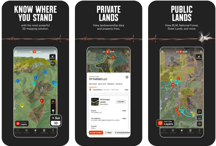
1. onX Hunt
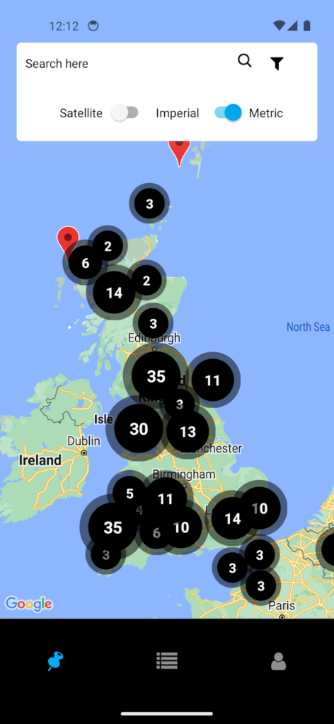
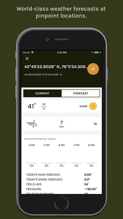
This app provides tools for hunters to navigate and plan their trips. It offers maps showing public and private land boundaries, helping users understand where they can hunt legally. The app includes features for marking locations and tracking movements in the field.
Users can save maps for offline use, which is helpful in areas without cell service. The app also provides weather information and tools for planning hunts based on terrain and game patterns. It supports both mobile and desktop use for scouting before heading out.
Additional features include options for viewing maps in different formats, like satellite or topographic, and tools for measuring distances. The app allows sharing of marked locations with others and integrates with some vehicle navigation systems for easier access in the field.
Key highlights
- Maps public and private land boundaries
- Offline map saving for remote areas
- Weather and terrain planning tools
- Supports mobile and desktop scouting
- Multiple map view options
- Location sharing and vehicle navigation integration
Contact Information:
- App Store: apps.apple.com/us/app/onx-hunt-gps-hunting-maps
- Website: www.onxmaps.com
- Facebook: www.facebook.com/onXmaps
- Instagram: www.instagram.com/onx_maps
- Twitter: x.com/onxmaps
- LinkedIn: www.linkedin.com/company/onxmaps

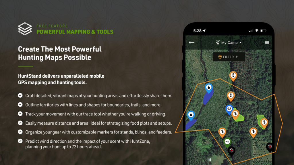
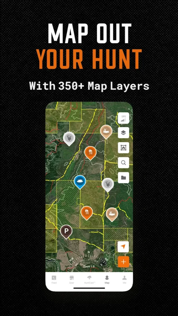
2. HuntStand
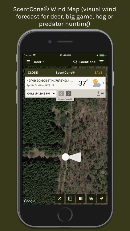
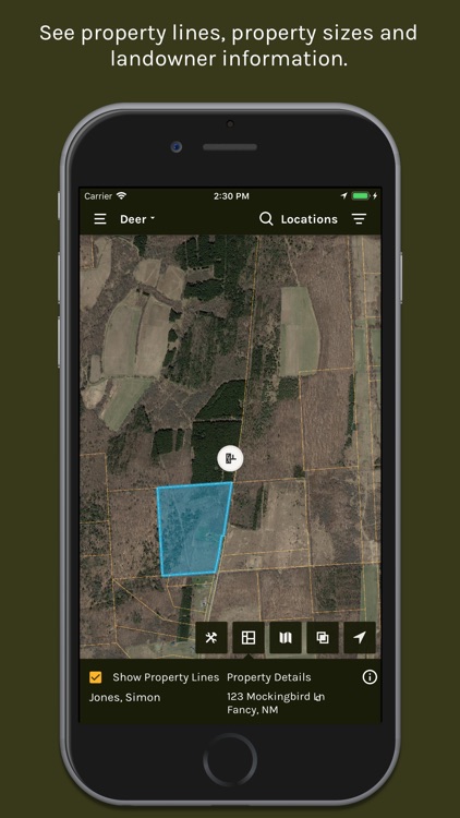
This app focuses on mapping and weather tools for hunters, particularly those targeting whitetail deer. It provides maps to show property lines, helping users avoid trespassing. The app includes features for marking hunting spots and tracking game activity.
The app offers weather forecasts tailored to hunting, including wind direction to help with scent control. Users can coordinate with others by sharing hunting plans and locations. It also supports offline map use for areas with no signal.
Additional tools include satellite imagery updates and options for marking trails or stands. The app provides group features for planning hunts with others and includes data on game movement based on weather and other factors.
Key highlights
- Property line and game activity mapping
- Weather forecasts with wind direction
- Group coordination and location sharing
- Offline map support
- Satellite imagery and trail marking
- Game movement data based on weather
Contact Information:
- Website: www.huntstand.com
- App Store: apps.apple.com/us/app/huntstand-gps-maps-tools
- Google Play: play.google.com/store/apps/details
- Facebook: www.facebook.com/HuntStand
- Instagram: www.instagram.com/huntstand

3. HuntWise
This app combines mapping with weather-based tools to help hunters plan their trips. It shows public and private land boundaries to guide legal hunting areas. The app includes features for marking spots and tracking game.
Weather forecasts in the app focus on conditions that affect hunting, like wind and temperature. It provides predictions for game activity to help users choose the best times to hunt. The app supports offline maps for use in remote areas.
The app also offers tools for connecting with other hunters to share tips or plans. Users can access satellite and topographic maps and mark locations for future reference. It includes options for finding hunting gear deals.
Key highlights
- Public and private land mapping
- Weather and game activity predictions
- Offline map capabilities
- Social features for hunter connections
- Satellite and topographic map options
- Gear deal access
Contact Information:
- Website: huntwise.com
- App Store: apps.apple.com/us/app/huntwise-a-better-hunting-app
- Google Play: play.google.com/store/apps/details
- Facebook: www.facebook.com/huntwiseapp
- Instagram: www.instagram.com/huntwiseapp
4. BaseMap
This app provides mapping tools for hunters, focusing on land boundaries and trip planning. It shows public and private land areas to help users stay within legal hunting zones. The app includes features for marking locations and planning routes.
Users can access weather information to plan hunts based on conditions like wind. The app supports offline maps for areas without cell service. It also offers tools for analyzing terrain to find good hunting spots.
Additional features include satellite imagery and options for customizing maps with markers. The app provides data on game tag applications and allows users to save and share their hunting plans.
Key highlights
- Land boundary and route planning maps
- Weather-based hunt planning
- Offline map support
- Terrain analysis tools
- Satellite imagery and map customization
- Game tag application data
Contact Information:
- Website: www.basemap.com
- App Store: apps.apple.com/us/app/basemap-hunting-gps-maps
- Facebook: www.facebook.com/basemaphuntfish
- Instagram: www.instagram.com/basemap_huntfish
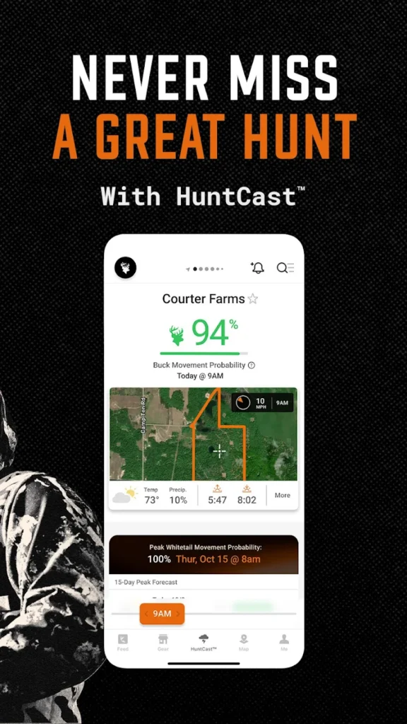
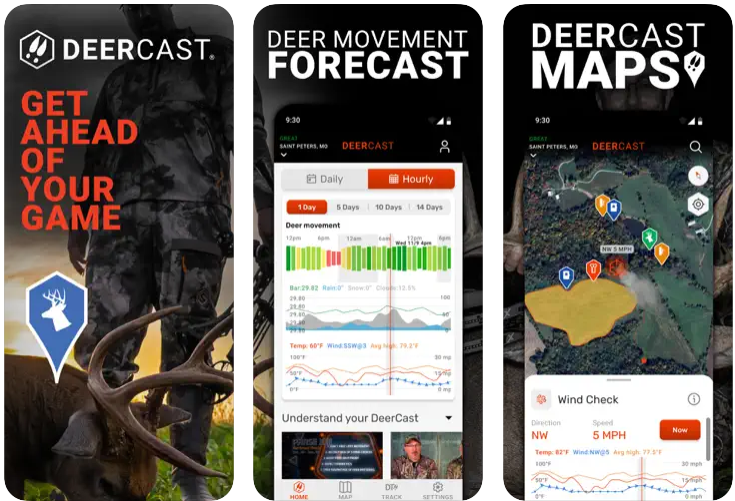
5. DeerCast
This app is designed for whitetail deer hunters, focusing on predicting game movement. It uses weather and other data to suggest the best times to hunt. The app includes tools for marking locations and tracking hunts.
Users can access forecasts that combine weather conditions with deer behavior patterns. The app helps with tracking game after a shot by logging trails. It also provides educational content on hunting strategies.
The app offers basic mapping features to mark hunting areas and includes weather details like wind direction. It supports planning hunts based on forecasts and allows users to save notes or locations.
Key highlights
- Whitetail deer movement predictions
- Weather and behavior-based forecasts
- Game tracking after shots
- Educational hunting content
- Basic mapping and weather tools
- Hunt planning and note-saving
Contact Information:
- Website: www.deercast.com
- App Store: apps.apple.com/us/app/deercast-prep-predict-pursue
- Facebook: www.facebook.com/OfficialDruryOutdoors
- Instagram: www.instagram.com/druryoutdoors
- Twitter: x.com/DruryOutdoors
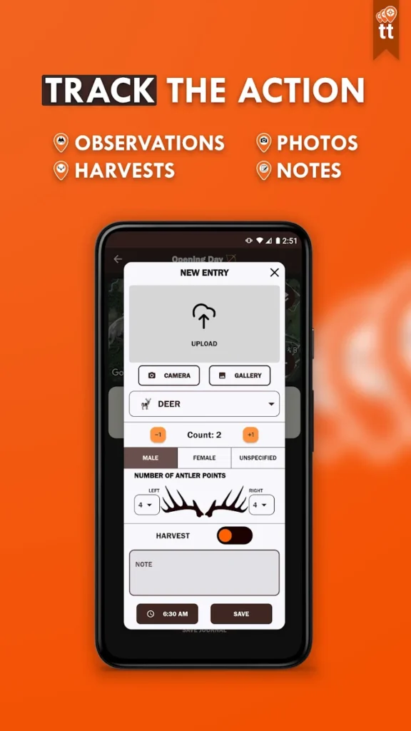
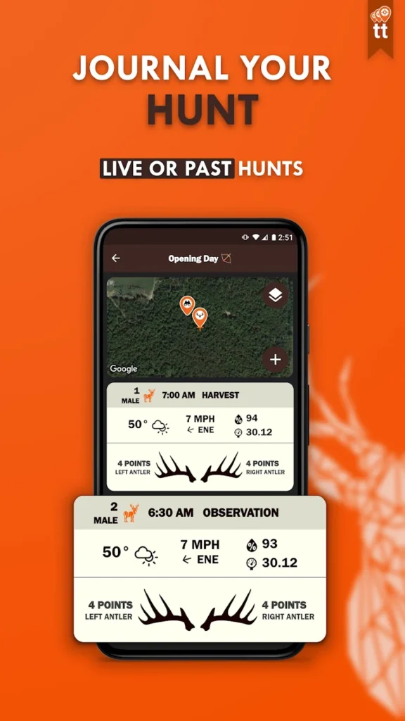
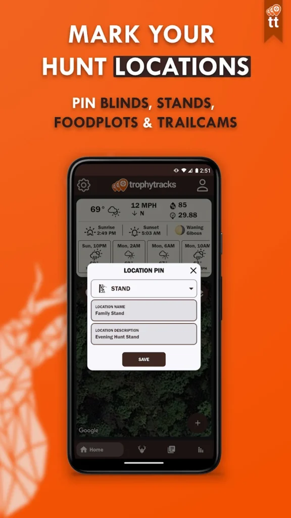
6. TrophyTracks
This app is for hunters who want to log their trips and manage game data. It allows users to record details about hunts, like locations and observations. The app supports organizing photos from trail cameras.
Users can add notes about weather or game sightings to their logs. The app helps keep track of hunting patterns by storing data over time. It provides a simple way to review past hunts for planning.
The app includes basic mapping to mark hunting spots. It focuses on keeping all hunt-related information in one place, with tools for categorizing and accessing photos or notes.
Key highlights
- Hunt logging and observation recording
- Trail camera photo organization
- Weather and sighting note-taking
- Basic mapping for hunt locations
- Data storage for past hunts
- Simple interface for data access
Contact Information:
- App Store: apps.apple.com/us/app/trophytracks-hunters-journal
- Google Play: play.google.com/store/apps/details
7. ScoutLook Hunting
This app combines weather and mapping tools for hunters. It provides maps showing property lines to help users stay in legal hunting areas. The app includes features for marking spots like stands or trails.
Weather information in the app includes wind and temperature details to plan hunts. It supports basic offline map use for areas with no signal. The app helps users track their movements in the field.
Additional tools allow marking locations for future hunts and viewing maps in different formats. The app focuses on providing free tools for hunters who need basic mapping and weather data.
Key highlights
- Property line mapping
- Weather details for hunt planning
- Basic offline map support
- Location and movement tracking
- Multiple map format options
- Free tools for basic needs
Contact Information:
- App Advice: appadvice.com/app/scoutlook-best-hunting-app
8. MoonGuide
This app uses lunar cycles to help hunters plan their trips, especially for whitetail deer. It suggests the best times to hunt based on moon phases. The app includes tools for marking hunting locations.
Users can access predictions that combine lunar data with weather conditions. The app helps plan hunts by showing when game might be more active. It provides a simple interface for checking moon-related data.
The app offers basic mapping to mark hunt areas and supports planning based on lunar and weather information. It focuses on hunters who use moon phases as a guide.
Key highlights
- Lunar cycle-based hunt planning
- Moon phase and weather predictions
- Basic mapping for hunt locations
- Simple interface for lunar data
- Game activity suggestions
- Focus on whitetail deer hunting
Contact Information:
- Website: moonguide.com
- App Store: apps.apple.com/us/app/deer-hunters-moonguide-3-0
- Facebook: www.facebook.com/moonguidehunting
- Instagram: www.instagram.com/moon_guide

9. PowderHook
This app provides mapping tools to find public hunting land. It shows boundaries and access points for legal hunting areas. The app includes features for marking spots and planning trips.
The app also offers a social platform for hunters to share tips or connect with others. Users can access satellite imagery to scout areas before hunting. It supports basic offline map use.
Additional tools include options for saving hunt plans and sharing locations with others. The app focuses on combining mapping with a community aspect for hunters.
Key highlights
- Public land mapping and access points
- Social platform for hunter connections
- Satellite imagery for scouting
- Basic offline map support
- Hunt plan saving and sharing
- Community-focused features
Contact Information:
- Website: powderhook.com
- App Advice: appadvice.com/app/powderhook-outdoor-intel
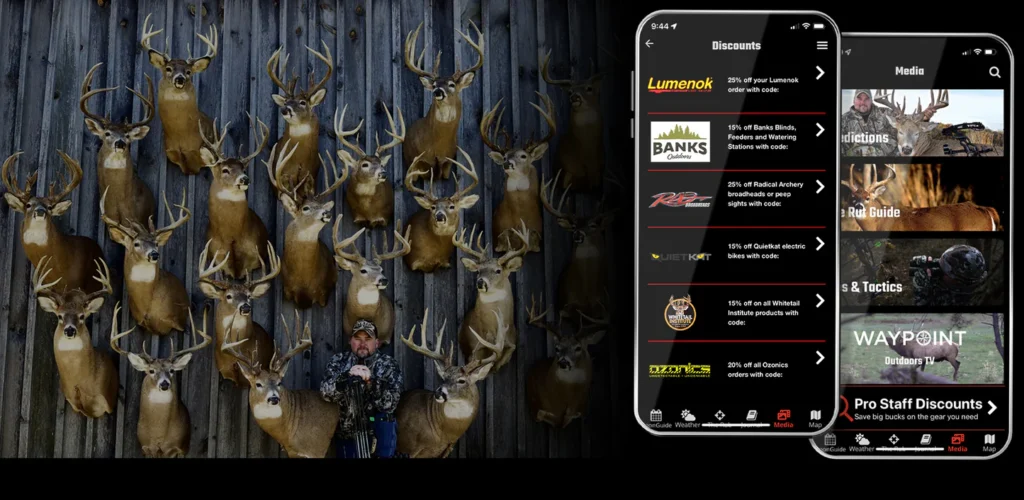
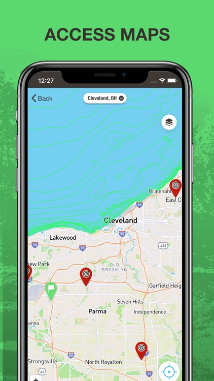
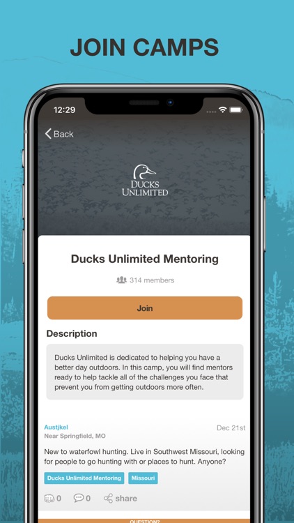
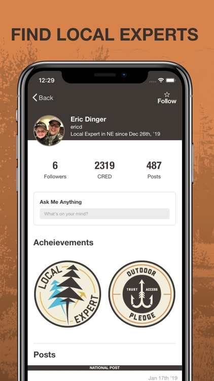
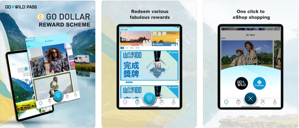
10. GoWild
This app is a social platform for hunters and anglers, with tools for logging trips. It allows users to share stories and photos with others. The app includes features for tracking hunts and saving notes.
Users can access a marketplace for hunting and fishing gear. The app helps connect people with similar outdoor interests. It provides basic mapping to mark hunting locations.
Additional tools include options for creating gear lists and logging hunt details. The app focuses on combining social networking with hunt tracking and gear access.
Key highlights
- Social platform for sharing stories
- Hunt and trip logging
- Gear marketplace access
- Basic mapping for locations
- Community connection tools
- Gear list and note-saving
Contact Information:
- Website: gwp.srlhk.com
- App Store: apps.apple.com/us/app/go-wild-pass
- Google Play: play.google.com/store/apps/details

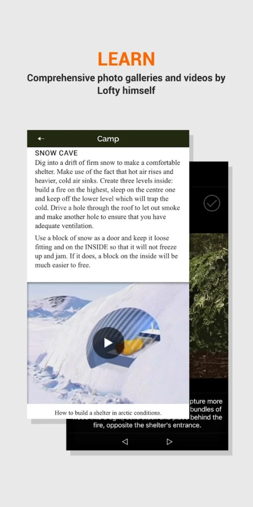
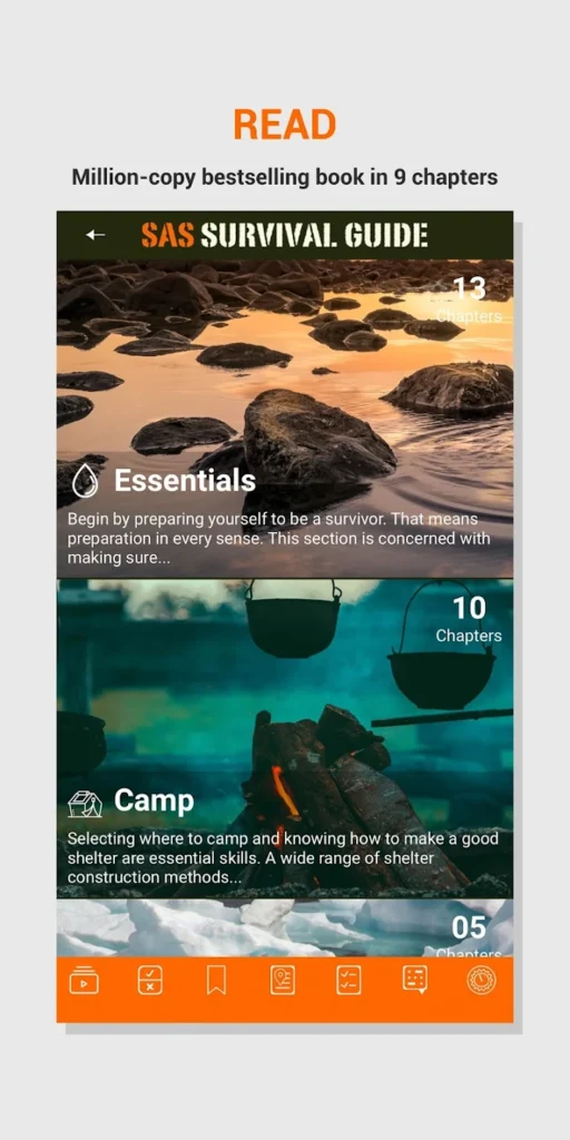
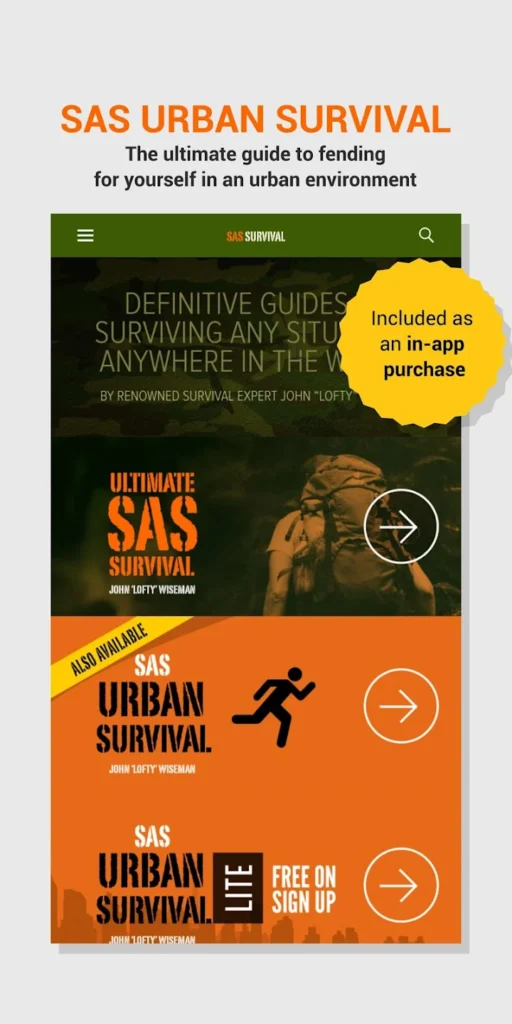
11. SAS Survival Guide
This app is a digital guide for surviving in the wild, useful for hunters in remote areas. It provides tips on handling outdoor challenges. The app includes tools for identifying animal tracks.
Users can access guides on tasks like tying knots or building shelters. The app offers videos and checklists for survival skills. It works offline to provide information without a signal.
The app focuses on preparing hunters for unexpected situations. It includes navigation tools like a sun compass and supports keeping all survival data in one place.
Key highlights
- Survival tips for remote areas
- Animal track identification
- Knot-tying and shelter guides
- Offline access to content
- Survival videos and checklists
- Basic navigation tools
Contact Information:
- Website: www.sassurvivalguide.com
- App Store: apps.apple.com/us/app/sas-survival-guide
- Google Play: play.google.com/store/apps/details

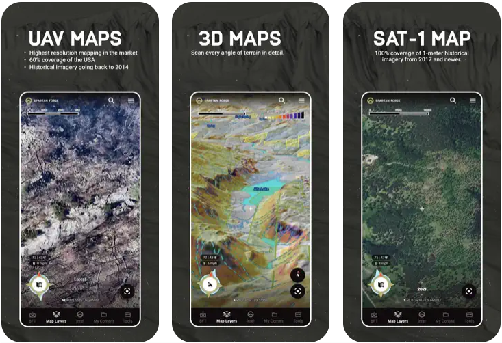
12. Spartan Forge
This app uses mapping and data tools to help hunters plan trips. It shows land boundaries and terrain details to guide legal hunting. The app includes features for marking locations and predicting game movement.
Users can access weather and behavioral data to plan hunts. The app supports offline maps for use in areas without service. It provides detailed terrain analysis for finding good spots.
Additional tools include options for sharing plans with others and viewing maps in different formats. The app focuses on combining mapping with game prediction features.
Key highlights
- Land boundary and terrain mapping
- Game movement predictions
- Offline map support
- Weather and behavioral data
- Plan sharing and map formats
- Terrain analysis tools
Contact Information:
- App Store: apps.apple.com/us/app/spartan-forge-hunt
13. HuntZone
HuntZone, a scent and wind tracking feature within the HuntStand app, helps hunters avoid detection by game. It includes tools for marking hunting spots. It helps users plan hunts to avoid detection by game. The app includes tools for marking hunting spots.
Users can access wind direction data to choose stand locations. The app provides predictions for scent movement based on weather. It supports group coordination for shared hunt plans.
The app offers mapping features to show property lines and mark trails. It focuses on helping hunters stay undetected while planning their trips.

Key highlights
- Scent and wind tracking
- Stand location planning
- Scent movement predictions
- Group coordination features
- Property line and trail mapping
- Weather-based planning tools
Contact Information:
- Google Play: play.google.com/store/apps/details

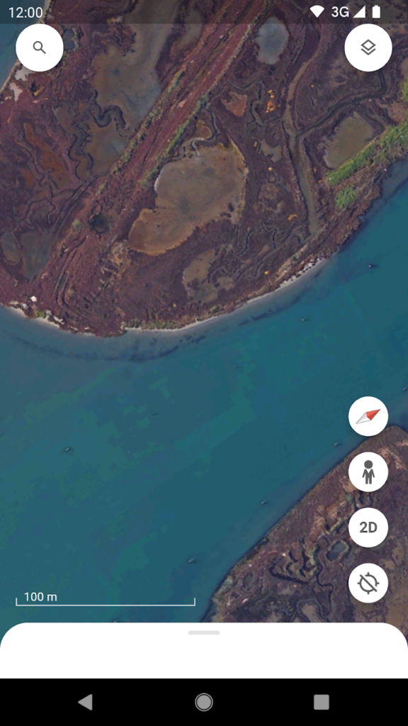
14. Google Earth
This app provides general mapping tools used by hunters for scouting. It shows satellite imagery and terrain details to plan trips. The app includes features for marking locations and routes.
Users can view maps in 3D to understand landscapes better. The app supports basic offline use for cached maps. It helps with finding access points and scouting areas.
Additional tools include options for saving waypoints and viewing historical imagery. The app focuses on providing detailed maps for outdoor planning.


Key highlights
- Satellite imagery and terrain mapping
- 3D map views
- Basic offline map support
- Waypoint and route marking
- Historical imagery access
- Scouting and access point tools
Contact Information:
- Website: earth.google.com
- App Store: apps.apple.com/us/app/google-earth
- Google Play: play.google.com/store/apps/details
Conclusion
These hunting apps provide practical tools to streamline your outdoor adventures, whether you’re navigating new terrain, tracking game, or planning the perfect shot. From detailed maps to weather forecasts, each app offers something unique to fit different hunting styles. Pick the ones that match your needs, and you’ll be better equipped for a successful trip. Get out there and make the most of your time in the wild!